Maps of the “Hungaries”
You will find here various maps of the region of the “Hungaries” (between 1541 and 1699: Royal Hungary, Ottoman Occupied Lands, the Principality of Transylvania) with short explanations:
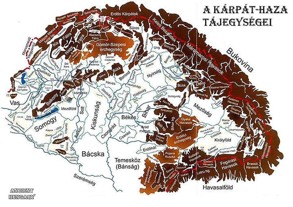
The geography of the Carpathian Basin in English:

The regions in the Hungarian language:

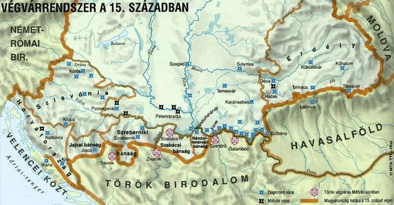
The southern Borderland in the 15th century:

Hungary slightly before the 15th century:

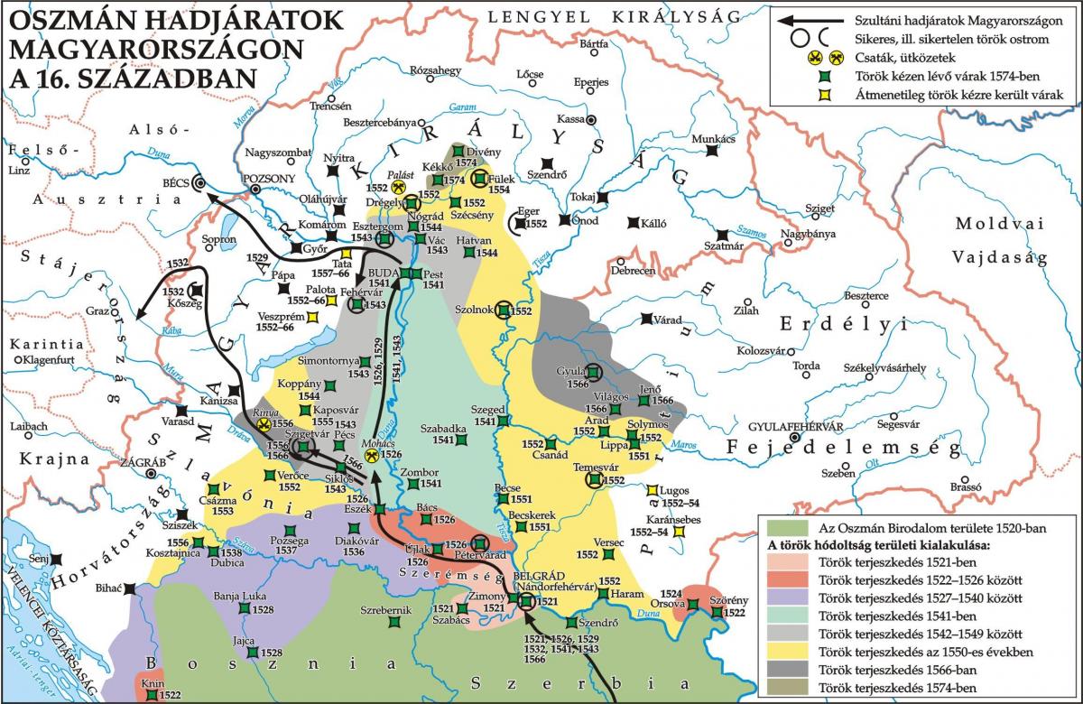
Ottoman campaigns against Hungary in the 16th century:

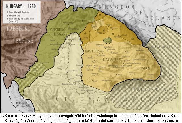
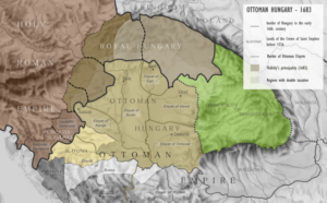
Hungary after the fall of Buda in 1541:

The position of the “Hungaries”:

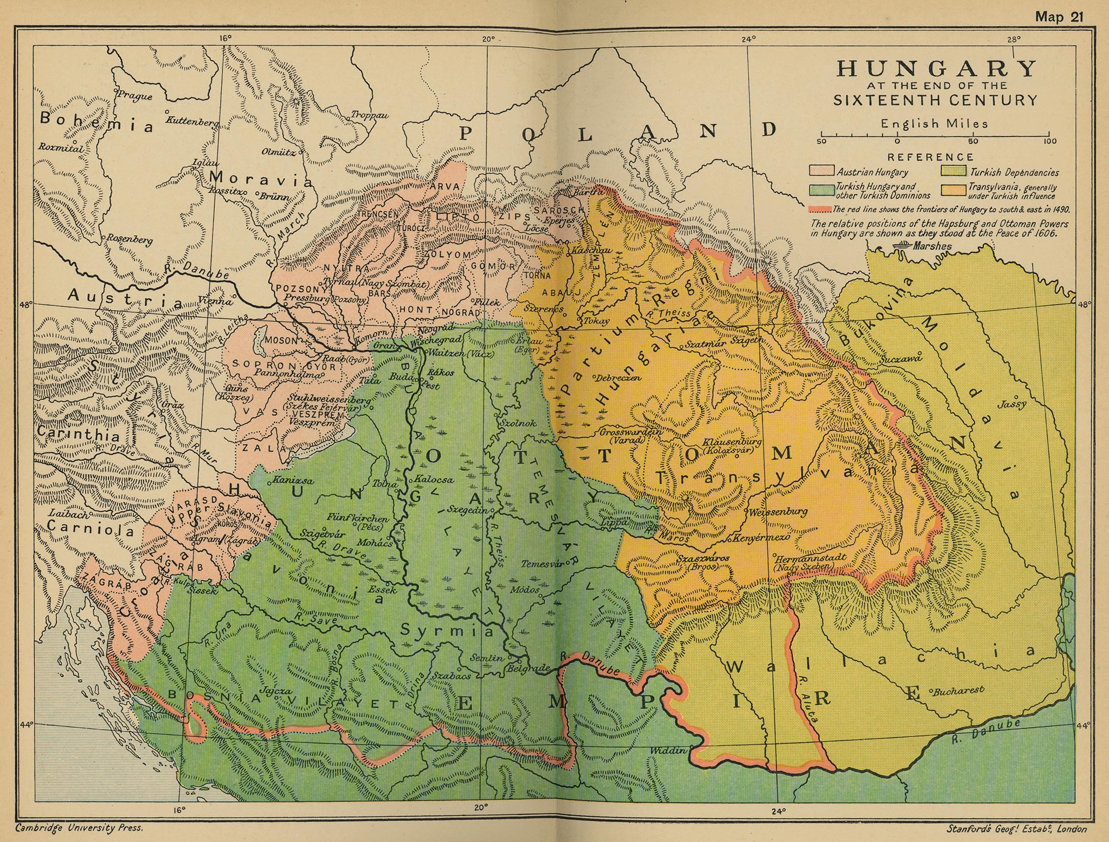
The Borderland system after 1580:

You can see the width of the northern Borderland zone; the settlements paid taxes to the Sultan as well as to the Emperor…

This map indicates the location of the Székely Hungarians and the German Saxons in Transylvania in the 1550s:

It is good to know the names of the 72 Hungarian counties:

You can see the castles held by the Ottoman Empire. According to contemporary payrolls, 95% of the Ottoman soldiers were South-Balkanian warriors, Albanians, Serbians, Bosnians, and Bulgarians.

Hungary and Croatia were divided into several bishoprics in the 16th century:

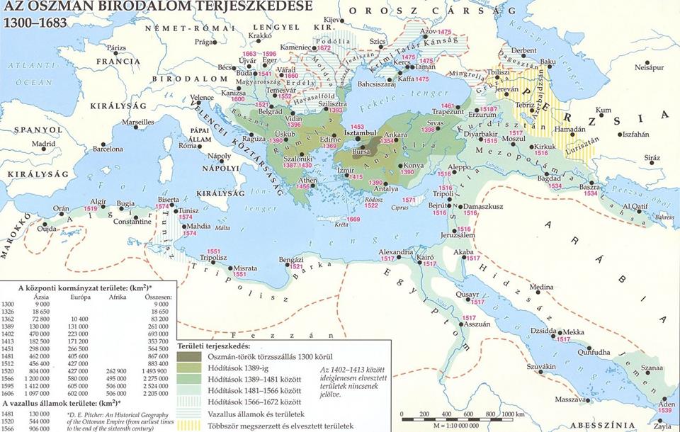
The expansion of the Ottoman Empire:

Europe at the beginning of the 16th century:

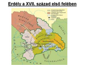
Transylvania in the first part of the 17th century:
Transylvania in the 16th century:

Lands belonging to the Habsburgs in 1547 (at that time they temporarily owned Transylvania, too):

Hungary in 1683, at the time of Prince Thököly Imre of Hungary and Transylvania:
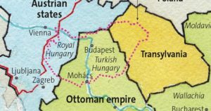
This map illustrates the modern and the old “Hungaries” in one map: the pink dots show you the modern borders. Again, there are just no perfect maps so you will likely find mistakes. Yet, the goal is to provide general information so not every detail must be crystal clear…:
Here is a general summary of territorial changes in Hungary from the 9th century to the modern days:

Dear Readers, I can only make this content available through small donations or by selling my books or T-shirts.
If you like my writings, please feel free to support me with a coffee here:
You can check out my books on Amazon or Draft2Digital, they are available in hardcover, paperback, or ebook:
https://www.amazon.com/dp/198020490X
or at https://books2read.com/b/boYd81


My work can also be followed and supported on Patreon:

Here are the maps in a gallery: