Rednek

Rednek (Врдник / Vrdnik) is a village in Serbia, in the Vajdaság (Voivodina) area, belonging to the Szerémség/Sirmium/Syrmia district. Syrmia (Srem/Срем or Srijem/Сријем) is a region of the southern Pannonian Plain, which lies between the Duna (Danube) and the Száva (Sava) rivers. It used to belong to the Kingdom of Hungary since the 10th century, in our days it is divided between Serbia and Croatia.
It was the best wine-producing area of the kingdom before the Ottoman conquest, the region of Tokaj became famous only when no more wine was coming from the Szerémség. Most of the region is flat, with the exception of the low Tarcal mountain (Fruska gora) stretching along the Danube in its northern part. Its old Hungarian name used to be Szerémország.

The major castles and settlements of the area are the next: Valkóvár (Vukovar), Vinkovce (Szentillye), Újlak (Ilok) van be found in modern Croatia while Árpatarló (Ruma), Belcsény (Беочин / Beočin), India (Инђија / Inđija), Karlóca aka Karom (Сремски Карловци/Sremski Karlovci, Srijemski Karlovci, Karlowitz, Karlofça), Ópazova (Stara Pazova, Стара Пазова), Pétervárad (Петроварадин / Petrovaradin, Peterwardein), Sid (Шид / Šid), Szávaszentdemeter (Сремска Митровица / Sremska Mitrovica, Srijemska Mitrovica, Mitrovica, Syrmisch Mitrowitz), Újbelgrád (Градска општина Нови Београд / Gradska opština Novi Beograd), Zimony (Земун / Zemun, Semlin) are located in modern Serbia. The Hungarian population was gradually disappearing from the Szerémség due to the Ottoman expansion, and mainly Southern-Slavic people settled there.

There is a ruined castle on a 385-meter-high hill of the Tarcal mountain (Fruska Gora), that used to be a larger castle in its heydays. It was first mentioned by Archbishop Demeter in 1315. The castle was easily defendable and it may have guarded the most important road between Rum and the Danube where we can see the remains of the Abbey of Dombó/Dumbovo in Ratkovac. Rednek was also called in the Middle Ages „Rednak”, „Rednuk”, „Regnicz”. These places have suffered a lot during the Turkish wars. Here you can read more about the fights taking place along the Southern Borderland of the Kingdom of Hungary during the first phase of the Ottoman wars:
Rednek had the right to keep weekly markets in 1329. The church of the place was mentioned in 1332-1361 and there was a Franciscan monastery in 1390. The castle was the property of the Archbishop of Kalocsa from the middle of the 15th century until 1500.

The stronghold of Rednek is now in a very ruined condition but it is the only castle in the ancient Szerém/Sirmium County whose structure is still clearly distinguishable. The castle`s foundation walls are 2.9 meters thick. Its entrance was on the Eastern side. There is a 20-meter-high round tower on the top of the cliffs which was defending the other tower; it was a real medieval bergfried, a “free-standing, fighting-tower”. Its defensive function is to some extent similar to that of a keep (also known as a donjon) in English or French castles. However, the characteristic difference between a bergfried and a keep is that a bergfried was typically not designed for permanent habitation.

This residential tower has the shape of a horseshoe, which can be entered through the first-floor entrance on the west side, from where a staircase leads to the upper rooms. You can see many carved stones that resemble the Gothic style. The castle was later repaired and bricks were used in the reconstruction instead of stones. The area of the whole castle is quite big. To the west, there is a slightly lower plateau where there is currently nothing but a little brick debris. This plateau (suburbium) was separated by a wall from the higher part where the residential tower stands.
The settlement belonging to the castle was a „civitas” of the church. It was taken by the Ottomans but could save its town-like rights in 1570 and as a result of this, it belonged to the so-called „háne” type of towns of the Ottoman Empire. It belonged to the Ottoman Nahije (district) of Ireg. There lived 3,704 inhabitants there in 2002, of them 2,769 Serbians, 131 „Yugoslav”, 86 Hungarians, and 78 Slovenians.

Dear Readers, I can only make this content available through small donations or by selling my books or T-shirts:
Please, feel free to support me with a coffee here:
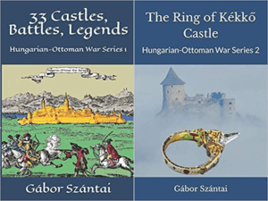
You can check out my books on Amazon or Draft2Digital, they are available in hardcover, paperback, or ebook:
https://www.amazon.com/dp/198020490X or at https://books2read.com/b/boYd81
My work can also be followed and supported on Patreon: Become a Patron!http://Become a Patron!
[wpedon id=”9140″]
https://hungarianottomanwars.myspreadshop.com/all


